Undergraduate Cartography
A sample of labs from Cartography and Data Visualization | UW Tacoma
 We were asked to focus on visual hierarchy at the US scale
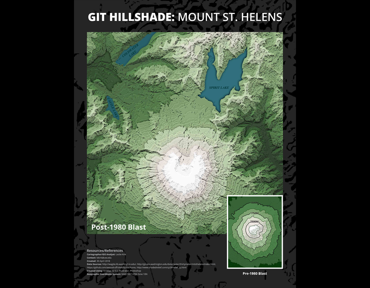 Using DEM files, hill shades, and other tools we were asked to create a terrain map
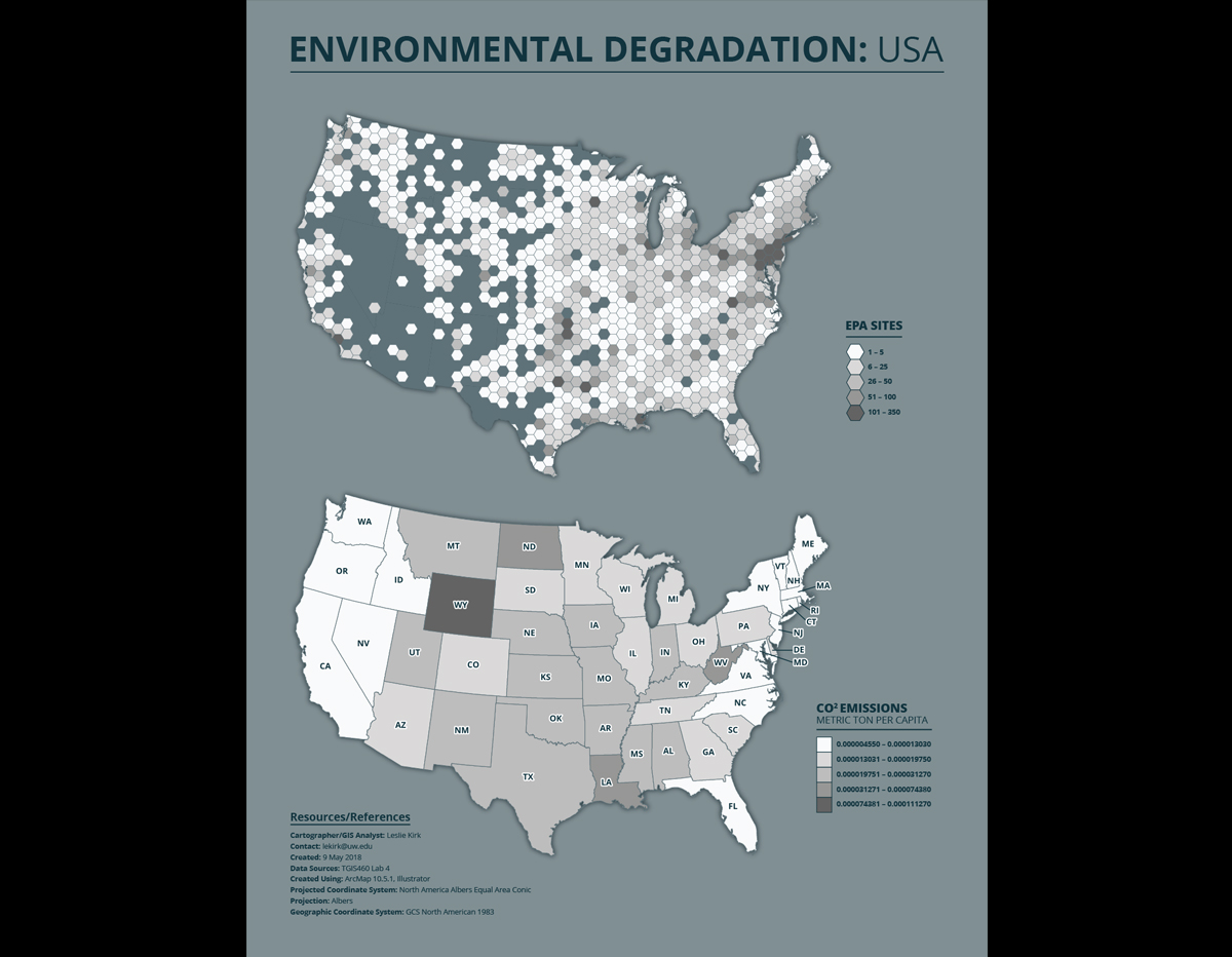 We were tasked with producing two visualizations at the 8.5” x 11” scale: one in hexbin format, and one as a traditional choropleth
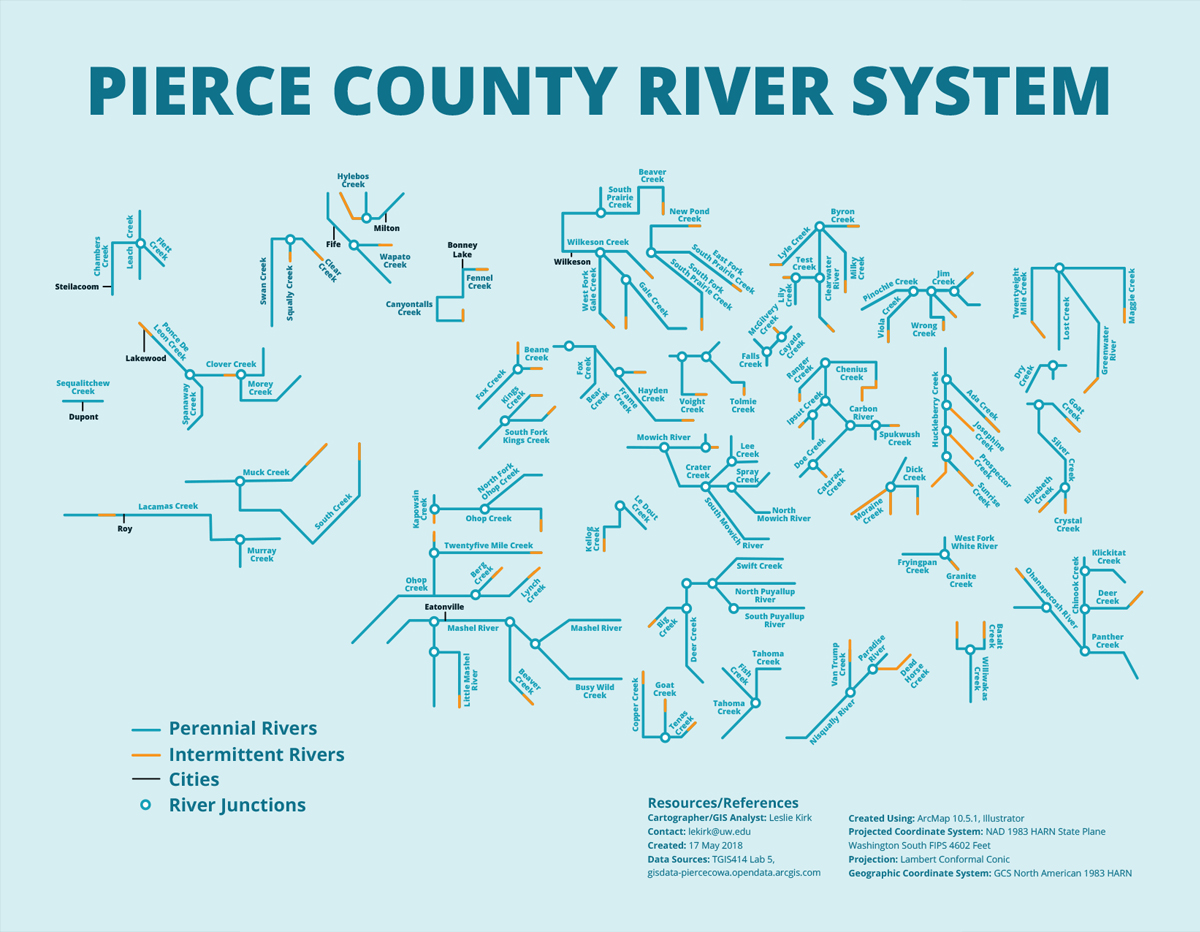 Using the National Hydrography Dataset at the largest resolution possible, we were to practice various techniques of generalization